West Bay Geology
Further Afield
West Bay Geology
Further Afield |
|
The pebbles and rocks found on Chesil Beach are believed to be the remains of previous beaches that formed at the end of the major river that used to occupy the base of what is now the English Channel (See below), so can be considered a recycled beach. Most of the rocks are very hard cherts, flints or quartzites and these have probably had a very interesting history almost certainly having been moved from one beach location to another multiple times.
It is thought that the rising sea levels (yes, that one again) at the end of the last ice-age is behind the current location of the shingle bank and of the lagoon behind. The basic idea is that as sea levels rose the original beach was left "out at sea", and forced to start relocating itself back towards the land. However, as the rate of sea level rise was quicker than the natural rate of migration of the shingle the poor beach has not yet managed to make it back to land, leaving a lagoon in the gap behind it. It is quite likely that this migration process might have happened multiple times. The hard rocks of the beach will take a lot longer to finally wear down, so, who knows where they will end up next?
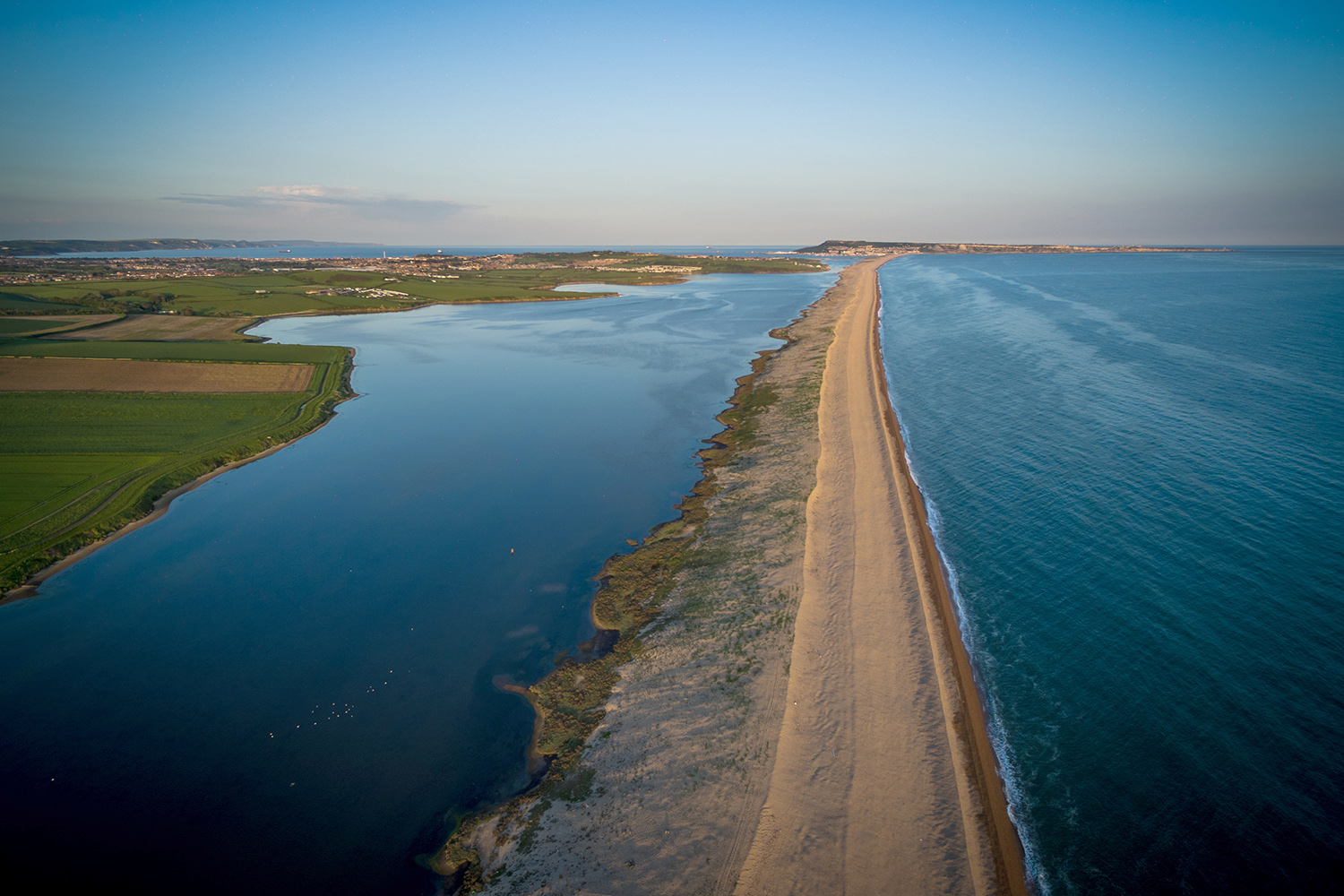
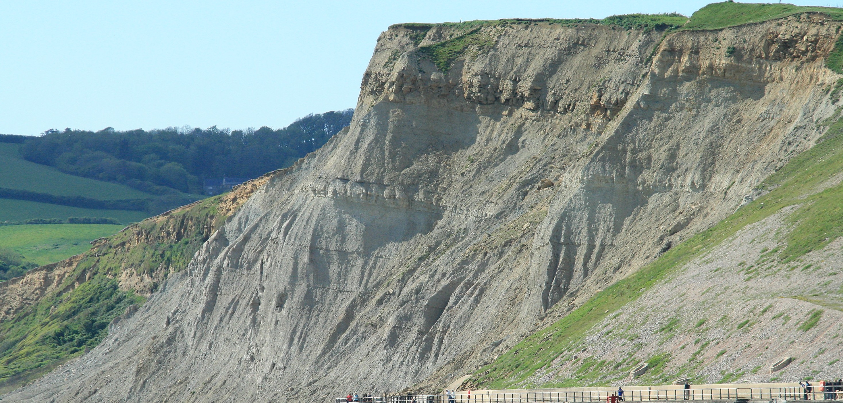
It is also a rather sad fact that Chesil Beach (as well as needing to catch up with sea-level rises) is shrinking, at least in length. It used to start at West Bay but now formally starts at Burton Bradstock, and the height and width of the beach is reducing over human and not geological timescales. The reasons for this decline are various, though it is certain that the sea defences at West Bay are reducing the ability for Chesil Beach to get new material from the west. It is quite possible that in a few hundred years Chesil Beach might start to break up altogether. This is not good news for the iconic golden coloured East Cliffs. They are protected by the beach and if this goes, cliff erosion will accelerate, as will the erosion of the softer clays to the east of Burton Bradstock and in West Cliff. It is quite possible that in 500 years East Cliff could have changed to be Sea Stacks of harder sandstone rising dramatically out from the Sea, with the main part of the coastline being somewhere in the middle of the golf course. Landing a gig on the beach for a summer swim would not be a thing any more, but as an alternative, island hoping excursions could be arranged if the conditions were good.
Further to the east is the Island of Portland. This is younger rock, from near the top of the Jurassic, and effectively the island is one great chunk of solid limestone that formed in shallow but sediment starved waters.
To the west you can see the Chalk cliffs of Beer. The Chalk is much younger, and the only reason this is visible here is because there is a fold in the rocks that brings the much younger chalk down to the sea level.
Beyond the Beer Cliffs on a good day you can see down towards the Red (Desert formed rocks) around Exmouth and even on to the even older Devonian rocks of Torquay and Brixham.
On such a good clear day a gaze to the West shows cliffs that are 450 million years old and a gaze to the East shows rocks that are well under 100 Million years old, not bad for one stretch of coast.
Next Section - Out to Sea
Previous Section - Beyond Eype
Back to Introduction