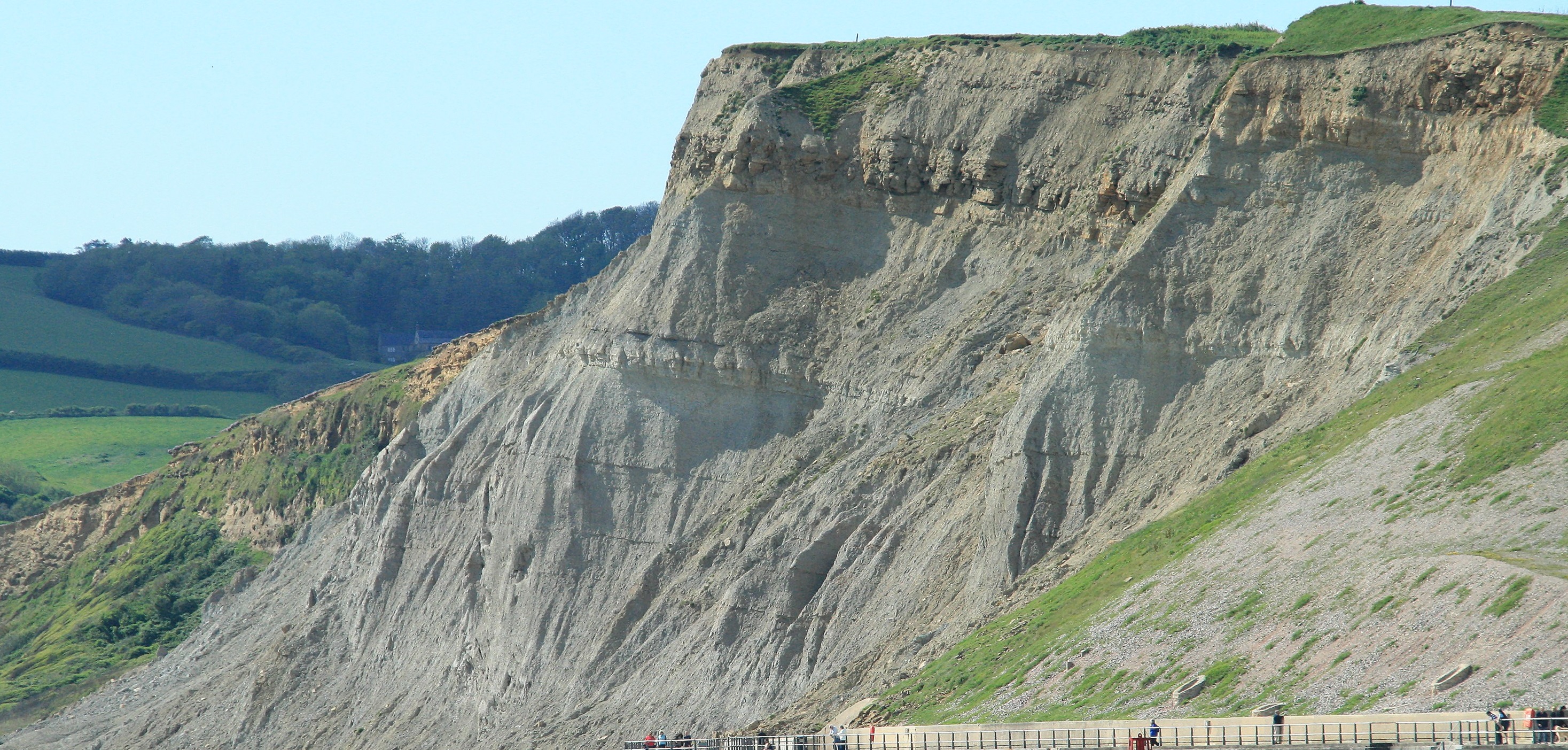
The English Channel is an item of interest in its own right. Even though it is now flooded, go back into the very recent past when sea levels were much lower due to water being tied up in the ice caps and it would have appeared as a complex river valley with fresh water draining away to the South West. When we look at flooded river valleys on the coast now, places such as Dartmouth or Falmouth we are seeing on a small scale what the English Channel used to be like but just on a much larger scale. At the peak of the most recent glaciation, ice covered the British Isles down as far as the M4, clearly even the ice had a tendency to get stuck in roadworks! South of this, water drained away through a series of lakes, rivers and gorges to join up into one large river valley system that existed at the centre of the now English Channel. Today the base of the English Channel is full of silt and mud, effectively a flat landscape (apart from the wreckage of ships) with most of the contours of the bedrock smoothed out by the mud and silt. But if this superficial silt is stripped away what would appear would be a complex series of river valley features. The image below shows a representation of the "under the silt" landscape at the bottom of the English Channel.
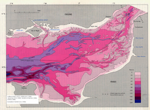
At the Straights of Dover there are two small egg shaped depressions, shown in a darker colour. These indicate the location of a sequence of waterfalls, more precisely the deep pits scoured out by the water crashing over the waterfall edges. There is very strong evidence here for both the damming up of melt water in a large lake in the southern North Sea, but also for this to have been breached in a quite dramatic fashion, with the formation of a major waterfall, something of a scale/size to match Niagara Falls, and at the time surely one of the wonders of the world. This waterfall scoured out deep pits as the cold ice melt water, accentuated by blocks of rock forced itself over the falls. These have now all be mapped out as part of the exploratory work to plan out the best route for the Channel Tunnel.
Being a bit fanciful, if we look back just 75,000 years (absolutely nothing in geological terms) then people could (and did) walk across the Channel between France and Dorset, quite probably needing to use prototype rowing gigs to cross the meandering ice cold rivers. Whilst doing this if they looked east they might have perhaps heard the crashing of water over the falls at the Straights of Dover and wondered what was causing the noise. Over time the river valley that would become the English Channel began to fill up with seawater, just as Dartmouth river valley has flooded, leaving the people who rowed over to Dorset stuck with a choice of either doing a 90 mile row to get back to France, or in setting up home here and making and drinking Apple Cakes and Beer, and more recently rowing Gigs. The people left in France of course started onion farming and more recently have sailed back over the flooded valley to sell us their produce!
Next Section - Conclusion
Previous Section - Further Afield
Back to Introduction