West Bay Geology
West of the Harbour
West Bay Geology
West of the Harbour |
|
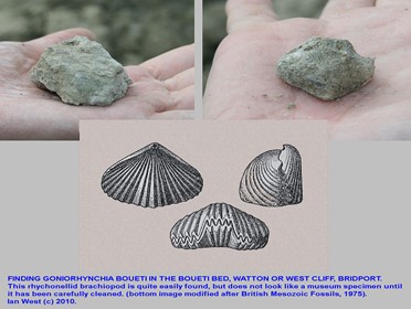
Half way up the cliff is a hard bed that stands out. This is a more solid limestone, created when even the clay was in short supply, and is packed full of a type of ancient shellfish called Boueti. This "Boueti Bed" can be followed over an extensive geographical area, and many museums have lovely specimens of Boueti on display, often with carefully hand written labels on them saying it was collected from West Bay. You can see several of these on display in the Natural History Museum.
Above this bed is another named formation, though the rocks look very similar. This is the Forest Marble. This is a range of rock types becoming more shelly towards the top. Again, fallen blocks of this, if found on the beach in a safe location, will almost always have fossils in them. Also, as the top is limestone rich, and as there are fewer such rocks available locally, it has been used to make lime, and you can see the traces of old lime kilns in the ground on the sea side of the footpath between West Bay and Eype. Spotting evidence for old Lime Kilns is actually a great way to trace out the changes in underlying rock, even when the actual rocks are covered in soil, vegetation or buildings.
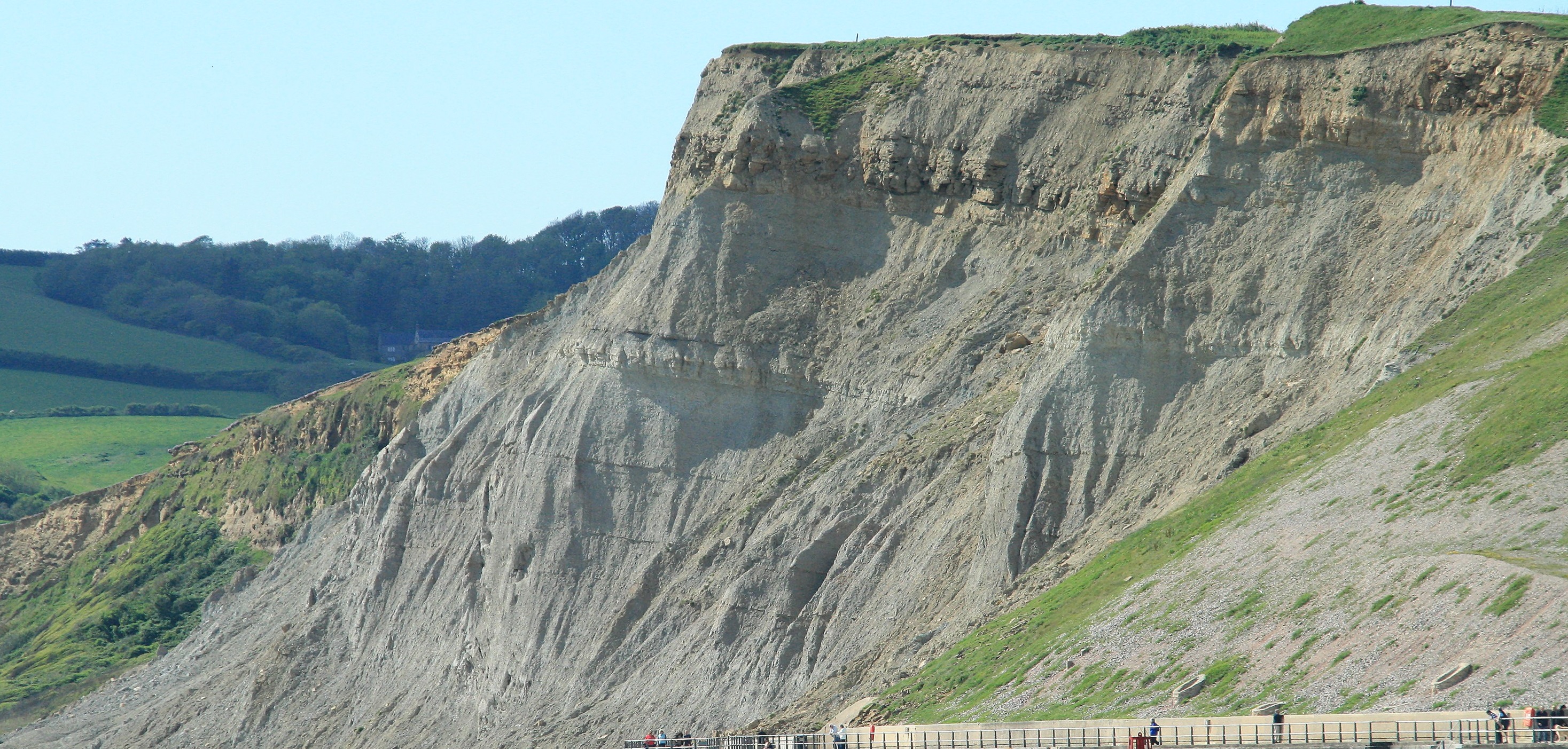
The rocks to the west of the harbour are clearly a different type of beast than the golden sandstone of the East Cliffs. They were deposited with much less supply of sand and other hard minerals, so probably a deeper water deposit, or it formed when the larger rivers delivering sand had shifted to other localities. It is also younger than the rocks to East. Note that this goes against the general pattern of "younger to the east". These rocks in fact belong about 200m further up the sequence, i.e. well above the cliff top of present day East Cliff. They are here because there are two faults that form a wedge shape, and where the wedge has (like a slice of cake), fallen down. It is perhaps slightly unfortunate that this wedge of rock did not fall down just a few metres less. Just under the beach there is an incredibly fossil rich layer of limestone called the Wattonensis Bed, after the old name for the cliff, Watton Cliff. In Victorian times this was a favoured place to go fossil hunting, a bit like the beach to the East of Lyme Regis is today. The list of the different types of fossils that have been collected from this bed runs to several pages. Sadly for us today this bed is now out of sight just below the beach. I have read that at particularly low tides and in the winter when the beach shingle is partly removed that this bed is visible but I think with the build up of the beach here caused by the new Sea Defences in West Bay that any such occurences will in the future be very rare.
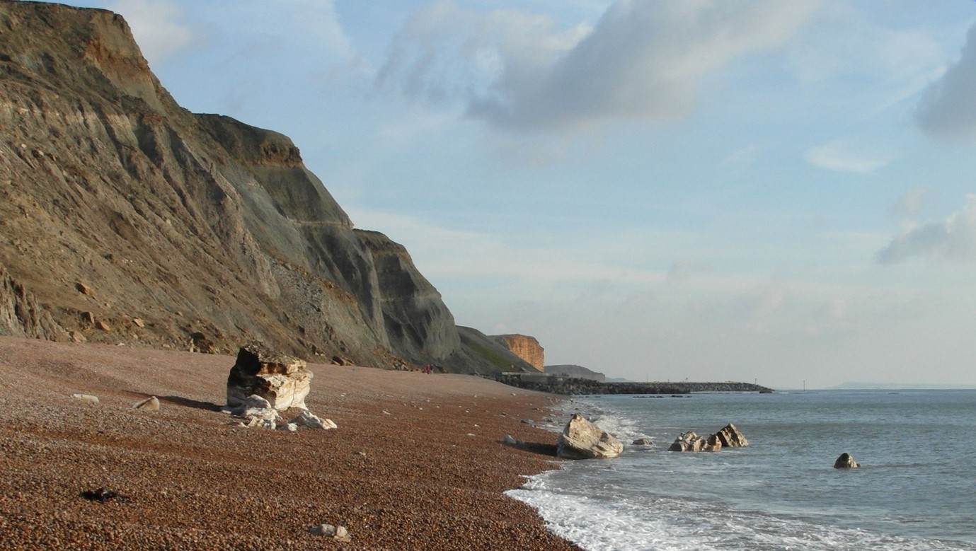
The photo above shows the grey cliffs of Frome Clay topped off with rubbly Forest Marble. The big blocks sitting on the beach are fallen blocks of the Junction Bed, a hard condensed limestone that marks the boundary (hence the name) between the middle and upper parts of the Lower Jurassic, see below for more details of this bed.
To the West of this picture the grey rocks of the cliff abruptly change back to golden/red rocks. The area where this change happens is called Fault Corner. It is where the western end of the wedge shape of faults emerges from the cliffs, and here you can see the actual path of the fault in plain view as a flat slightly inclined plane of greyish rock in the middle of the picture with red rock to the left and with jumbled and slipped light grey rocks to the right. If the lighting is good you can also see that the grey rocks bend up towards the fault plane, indicating how the rocks dragged and curved as the fault happened. It is surprisingly rare to see a fault exposed as well as this. In fact, it is so rare that almost all geological students from this country and also many from Western Europe end up on a field trip to this location to look at the fault! My first ever visit to this area was as a geological student, little did I know that I would one day live (and row) around here.
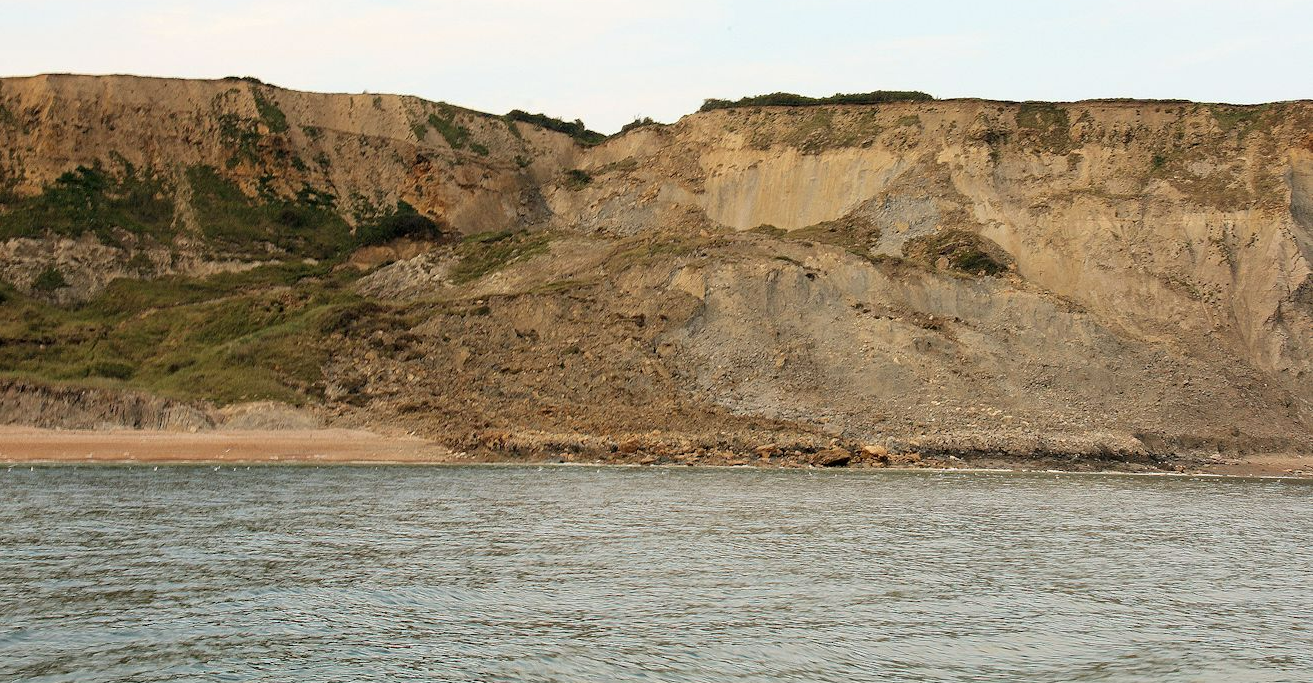
The picture above shows Fault Corner. To the right are the younger rocks that have "fallen down" by around 200m. To the left are the older lower Jurassic rocks. Much of the fault is now hidden by the recent landslips in the centre of the picture. However, you can see the line of the fault in the middle foreground as it "emerges" out of the cliff and heads out to sea.
Moving on to Eype we are now back into rocks that are part of the normal succession. These rocks are older than the red rocks of West Cliff (remember we are to the West so they should be older) and collectively form the lower part of the Jurassic sequence.
The sequence here is all named for local places. At the base is the Eype Clay, then there are the Down-Cliff Sands, these are followed by the Thorncombe Sands and at the top is a bed called the Junction Bed, named as this is the junction between the lower and middle parts of the Jurassic rock sequence. The alternation of Clays and Sands speaks about variations in the type, amount and location of sediments being delivered into the warm Jurassic seas. These specific variations are not the same here as in other places, for example Yorkshire, so it must have been quite local circumstances that decided whether rocks would be deposited as Clays or Sands.
There are fossils throughout these rocks, but the most interesting place to find fossils is in the Junction Bed. This is a hard (or at least harder) bed of limestone. It can be found all the way along the south coast, (and indeed inland, my house near Yeovil is built upon the Junction Bed), and is considered a "condensed horizon". This means that erosion was happening at the same time as deposition and hence a lot of time is actually represented in a very small vertical thickness of rock. Often you can find fossils that have been part worn away or tumbled around. There are very noticeable large blocks of Junction Bed stone on the beach between Eype and West Bay. These have fallen from high up near the top of the cliffs. If you are lucky, and also when the tide is low, you can see fossils on the exposed faces off these rocks.
Next Section - Beyond Eype Mouth
Previous Section - East of the Harbour
Back to Introduction