West Bay Geology
West Bay and the Harbour
West Bay Geology
West Bay and the Harbour |
|
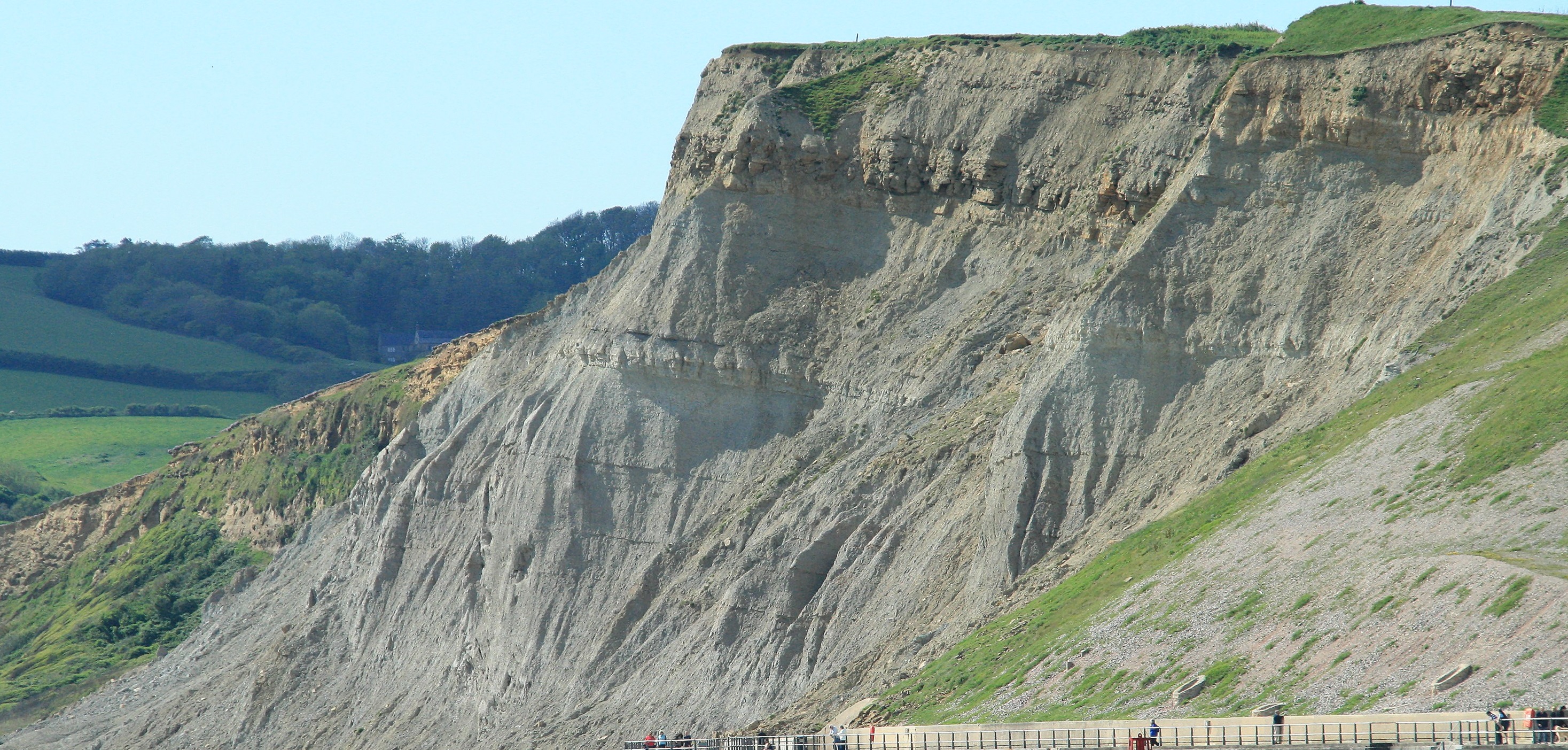
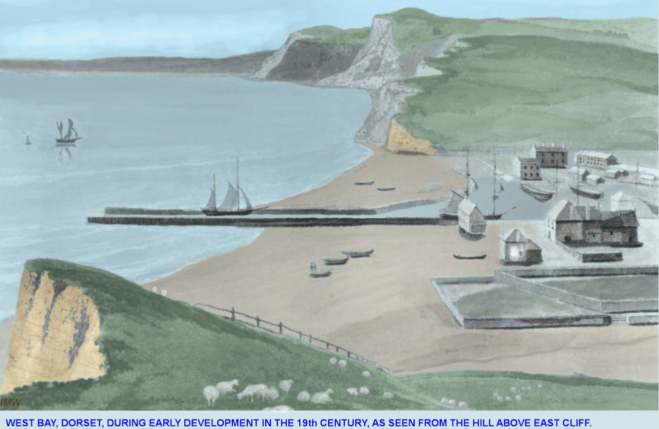
The controlling factors here are geologial faults. There is a set of faults (fractures in the rock) that have dropped the Grey rocks to the West down and pushed the Golden coloured rocks to the East northwards away from the sea. Rivers are very cunning things, and in this case the river has found the weakened and broken rocks caused by these faults and has used this as a way to find its way to the sea. If you could somehow strip away the houses, river gravel and sediments and remove the man-made sea defences and any soil and vegetation what you would see on the ground would be two zones of shattered rocks. One in a North to South orientation around the edge of the Grey Cliffs heading to Eype and the other crossing the harbour in a roughly East/West direction. You can still see an indication of this later shatter zone in the road that we take the gigs up to the outer harbour. As we head up to the Mound we are forced to push hard to lift the heavy boats uphill. This hill marks the line on the ground where the fault exists as it heads its way across the harbour. I understand that in the Victorian era the other shatter zone was clearly visible in East Cliff, and that there was even a small block of Golden Sandstone at the foot of the cliff, this being an outcrop of the Bridport Sands, shifted into this position by the fault. For any coxes reading this, the (mostly) worn down outcrop of Bridport Sands is also the reason why there is a annoying and worrying shallow region just offshore from the modern sea defences at the start of the Promenade. The picture below shows what the harbour might have looked like then. I think there is something like a gig boat shown sitting high up on the beach. Clearly the pontoons were out for the winter when this was drawn!
I have also attempted to draw a very simplified map of what the faults around the harbour look like.
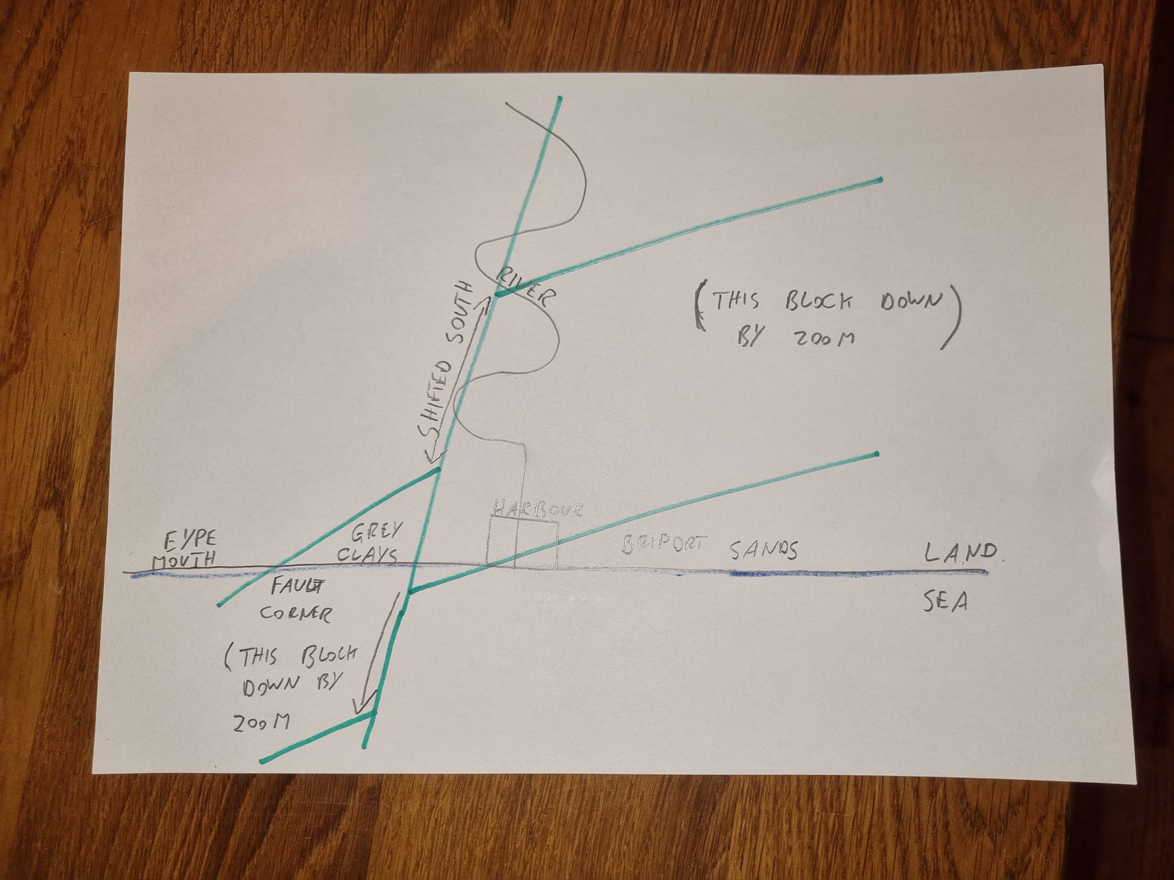
This attempts to show the way that blocks of rock have been moved around, and please don't laugh at my graphic attempts here! What I am trying to show (quite badly!) is the interaction between the North/South and the East/West faults, and how this controls where the cliffs are and what colour rocks you see in them. The section of rocks in-between the diagonal green lines has been "dropped" down, and the bit to the right of the vertical green line has been "shifted" north. As a bit of a personal challenge, can you work out which set of faults came first? Going a bit further what does this say about the order and direction of movements in the crust? Finally how could this order of events be used to indicate the general direction of expansion of the North Atlantic? Catch me on the water with your answers, or perhaps make a Facebook post?
For those living on West Cliff, or in the new Apartments by the harbour I don't know if the fact that your house is built on (or close to) a fault (in fact two faults!) should be of concern? Probably not, but perhaps you should have an earthquake evacuation plan to hand just in case!
These faults did not happen in the Jurassic. The activity probably happened in the late Cretaceous period, i.e. around 70 Million years later, and coincidentally just before the asteroid that wipped out the dinosaurs crashed into the Yucatan Peninsular in Central America. The Jurassic sediments had been deposited, buried and consolidated into rocks and then found themselves being subjected to stress as part of the opening of the North Atlantic. The North Atlantic was one of the last parts of the Pangaea Super-Continent to split apart. Prior to this Europe was connected in one landmass to Greenland and North America and an intrepid dinosaur could have quite easily walked from London to New York. However, the continued movement of the crustal plates meant that over time a split appeared in the once single land-mass. This split was accompanied by large forces, effectively stretching the rocks as if they were a large elastic band. When the rocks could stretch no further then just like an elastic band they fractured, leading to faults like the ones we see here. The whole of the UK suffered the same fate and pretty much wherever you go you can find faults which relate to the splitting of the crust and the formation of the North Atlantic. Many of these faults run in a North/South orientation as this is the general direction in which the split occurred. However, some also run in other directions, often following lines of far older faults that still exist deep down in the crust.
I find it interesting to consider that the shape of the coast, the position of the harbour and even the slight hills within West Bay itself all relate back to the forces that caused the North Atlantic to start to open up around 70 Million years ago. Of course, the Atlantic is still opening up, and we are getting around 2cm further away from North America every year.